Détail de l'itinéraire
Description
Ce parcours vous est proposé par le Comité Régional de Randonnée Pédestre. Au départ d’une gare ou d’un arrêt de car TER, il vous permet de rejoindre un itinéraire de promenade ou de randonnée et de vous balader en écomobilité !
Votre itinéraire
Étape 1 : Port Boinot
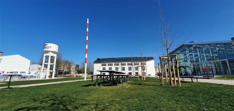
Ancienne chamoiserie jusqu'en 2006, puis Centre National des Arts de la Rue de 2010 à 2015, Le Port Boinot, c'est entre les ponts Main et la Sèvre Niortaise :
– Un grand parc urbain en connexion avec le Parc Naturel Régional du Marais poitevin (2020)
– Une déclinaison de 6 jardins thématiques
– La reconversion de bâtiments industriels : la maison patronale en restaurant (2023), la fabrique en lieu événementiel pour les entreprises et le grand public (2023), le grand séchoir en comptoir des itinérances et des randonnées (Office de Tourisme en 2021), espace d’information et sensibilisation aux richesses patrimoniales de Niort Agglo et lieu de mémoire de la chamoiserie (2021), les ateliers du port en espace dédié aux pratiques de loisirs sportifs (location de vélos et d’embarcations légères) et événementielles (bar-resto-concert-expo d’art contemporain L’ilôt sauvage)…
Étape 2 : Ecluse de comporté
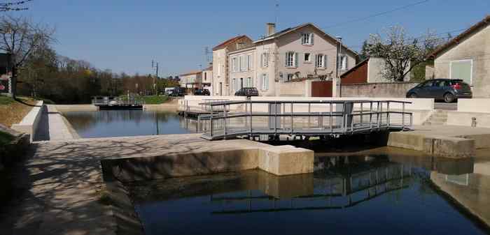
Construit en 1862, cet ouvrage de navigation, toujours en état de fonctionnement, permet aux bateaux de franchir la dénivellation entre le bief de Comporté et celui de La Roussille. Depuis mi-mai 2020, sa rénovation (restauration des structures maçonnées, remplacement des portes et passerelles métalliques, révision des mécanismes) est portée par l'Institution interdépartementale du bassin de la Sèvre niortaise (IIBSN), en charge du domaine public fluvial. Cette opération s’inscrit dans le projet de développement de la navigation touristique entre Niort et Marans. Elle fait suite aux restaurations des écluses de La Tiffardière et de La Roussille réalisées en 2018.
De nombreux oiseaux nicheurs, dont le héron, apprécient les abords arborés de l’écluse de Comporté.
Étape 3 : Quai Métayer, ancien chemin de halage
Le quai Métayer suit le canal navigable. En 1808, un décret impérial est déclaré afin de faciliter la navigabilité du fleuve. Le cours de la Sèvre est dégagé de tout obstacle (moulins, usines, pêcheries…).
La largeur du chemin de halage est fixé à 6 mètres afin que les gabares, longues embarcations à fond plat utilisées pour le transport des marchandises, puissent être “hâlés” (tirés à l’aide de cordes par des hommes ou des chevaux). Cela entraîne l’arrachage d’arbres et de souches de buissons responsables des déchirures des voiles des navires.
Étape 4 : Bateau à chaine
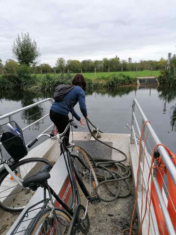
Ce bateau, propriété de la ville, est à la disposition de tous pour passer d’un côté à l’autre de la rivière par un système astucieux de chaînes arrimées à chaque berge (remplacées depuis par des cordes, à cause du problème de nuisance occasionné auprès des riverains). La tradition orale évoque l'existence de passages par bateau d’une rive à l’autre de la Sèvre, par exemple, pour que les enfants, qui habitaient la ferme de Chey, puissent rejoindre l’école de Saint-Liguaire.
Étape 5 : Ecluse de la Roussille
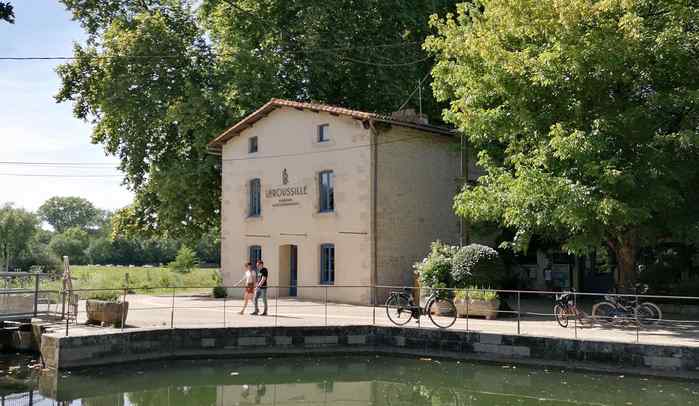
Du mot poitevin roussea signifiant à la fois roux et ruisseau, La Roussille est le lieu où poussent les rouches, c’est-à-dire les joncs.
Son écluse est installée en 1394 par le duc Jean de Berry, comte de Poitou, pour retenir les eaux de la Sèvre Niortaise dans le canal et le bassin de Niort. Elle est la plus importante des huit écluses de Niort à Marans (Charente-Maritime) et une des premières écluses à sas de France. La date de 1808 est gravée dans la pierre de l’ancien poste de l’éclusier pour rappeler le passage à Niort de Napoléon 1er qui a réglementé par décret la navigation sur la rivière.
Dans le prolongement de l’actuel restaurant, l’ancienne grange de la maison éclusière abritait le cheval utilisé sur le chemin de halage pour tirer les gabares sur le petit fleuve côtier.
Étape 6 : Marais du Galuchet
Aux portes de la ville, ce confetti vert protégé s’étend sur 40 hectares, en bord de Sèvre. Il est composé de prairies d’élevage, d’une petite forêt alluviale (« Guyane niortaise »), d’une ancienne pêcherie (10 hectares de fossés de 6 mètres et de buttes de terre de 3 mètres de large), d’une roselière, d’une mégaphorbiaie (univers de grandes herbes hygrophiles résultant de l’abandon de prairies humides), d’un coteau et de la plus grande héronnière du Sud Deux-Sèvres.